|
In 1999, the Utah Reclamation Mitigation and Conservation Commission
began the Provo River Restoration Project (PRRP) between Jordanelle Dam
and Deer Creek Reservoir in Wasatch County, Utah. River reconstruction was completed in 2008.
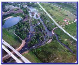
River reconstruction entailed moving the straightened river channel into excavated meanders mimicking historic conditions, reconnecting the river to existing remnants of historic secondary
channels, and constructed small side channels and ponds to recreate aquatic
features and provide wetland and wildlife habitat. Existing levees were set back
to create a near natural flood plain and to allow the river to change
course naturally. The project also entailed acquiring an 800 to 2,200-foot-wide continuous
corridor the length of the middle Provo River protected for
angler access and wildlife habitat.
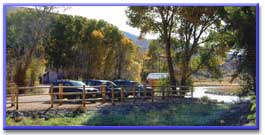
 Public access to the corridor is designated at seven parking areas that include restrooms, trash recepticles and information displays. Two of the sites also provide accessible fishing platforms. An additional four- to six-car parking lot may be constructed near the head of the Wasatch Canal/Rock Ditch system. Public access to about ½ mile of this stream was obtained through purchases made for the PRRP. The purpose for constructing this small parking area would be to reduce illegal parking along old Highway 40 near the Wasatch Diversion. Click here for a corridor map and more information about access to the middle Provo. Public access to the corridor is designated at seven parking areas that include restrooms, trash recepticles and information displays. Two of the sites also provide accessible fishing platforms. An additional four- to six-car parking lot may be constructed near the head of the Wasatch Canal/Rock Ditch system. Public access to about ½ mile of this stream was obtained through purchases made for the PRRP. The purpose for constructing this small parking area would be to reduce illegal parking along old Highway 40 near the Wasatch Diversion. Click here for a corridor map and more information about access to the middle Provo.
 Planting and fostering streamside vegetation needed for a healthy fishery has been ongoing since the project began. Monitoring of this habitat, as well as other physical features and sensitive
species also continues. Specific studies include: monitoring
native and game fish populations; monitoring macroinvertebrate (stoneflies,
mayflies, midges, etc.) populations; conducting bird, including Bald Eagles,
and bird habitat studies and surveys; surveying for spotted frogs, which are on Utah’s
Sensitive Species List; assessing native riparian
and wetland areas and monitoring revegetated areas; and, monitoring
hydrological conditions and conducting flow and river mechanics studies. Planting and fostering streamside vegetation needed for a healthy fishery has been ongoing since the project began. Monitoring of this habitat, as well as other physical features and sensitive
species also continues. Specific studies include: monitoring
native and game fish populations; monitoring macroinvertebrate (stoneflies,
mayflies, midges, etc.) populations; conducting bird, including Bald Eagles,
and bird habitat studies and surveys; surveying for spotted frogs, which are on Utah’s
Sensitive Species List; assessing native riparian
and wetland areas and monitoring revegetated areas; and, monitoring
hydrological conditions and conducting flow and river mechanics studies.
The PRRP mitigates for damages associated primarily with CUP construction.
Making up for these damages was necessary, whether through the
PRRP, or otherwise. Examples of these mitigation commitments and the projects that made them necessary are:
The Provo River Project, which dammed and then channelized, straightened, and diked the middle Provo
River in the 1950s and 60s.Many of the river’s abundant resources were lost, such as
riparian forest, emergent wetland, backwater and deep fishing holes - prime fish and wildlife habitat.
The Strawberry Aqueduct and Collection System, which dewatered many miles of streams on the south
slope of the Uinta mountains and significantly reduced trout populations. As a result, the federal
government was required to restore fish habitat and provide angler access elsewhere.
Jordanelle Reservoir, which inundated four miles of Provo River and association wetlands.
To offset its impacts, providing angler access, acquiring and restoring riparian woodlands, and
providing a 125 cfs minimum flow year round from Jordanelle Dam were conditions for its
construction. |

