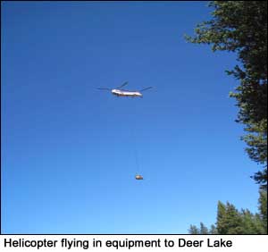
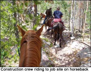
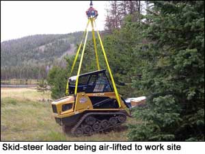
 Stabilizing these lakes was a particular challenge due to their remote locations. Specialists determined that for some lakes, the only safe way to complete stabilization in one season required use of mechanized and motorized equipment. Hence, to protect the surrounding wilderness, special approval was obtained from the U.S. Forest Service and equipment and materials were air lifted to the work sites via helicopter. Crews reached the sites by foot and horseback. Stabilizing these lakes was a particular challenge due to their remote locations. Specialists determined that for some lakes, the only safe way to complete stabilization in one season required use of mechanized and motorized equipment. Hence, to protect the surrounding wilderness, special approval was obtained from the U.S. Forest Service and equipment and materials were air lifted to the work sites via helicopter. Crews reached the sites by foot and horseback.
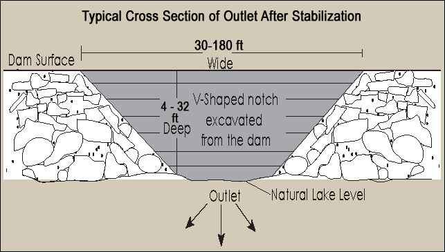
 Generally, the stabilization process required removing stop logs, which were in place to reduce erosion and help maintain stability of the dams, and stone rip-rap facing that lined the outlet and upstream potions of each dam. A broad, v-shaped notch was then cut into each dam creating a channel at or near the lakes natural level. In this way, lakes could return to their natural hydrologic flow. Rip rap was then replaced along the breach and upstream portion of the new channel. Old headgates were removed and outlet pipes either removed or plugged; however, parts of each historic dam were left in place to preserve them as part of the local heritage. Generally, the stabilization process required removing stop logs, which were in place to reduce erosion and help maintain stability of the dams, and stone rip-rap facing that lined the outlet and upstream potions of each dam. A broad, v-shaped notch was then cut into each dam creating a channel at or near the lakes natural level. In this way, lakes could return to their natural hydrologic flow. Rip rap was then replaced along the breach and upstream portion of the new channel. Old headgates were removed and outlet pipes either removed or plugged; however, parts of each historic dam were left in place to preserve them as part of the local heritage.
Follow the links below (also in the menu above) for details on the stabilization process at each reservoir:
Stabilizing the Lake Fork Watershed
Brown Duck Basin
Clements Lake
Island Lake
Kidney Lake
Brown Duck Lake
Stabilizing the Yellowstone Watershed
Garfield Basin
Superior Lake
Five Point Lake
Drift Lake
Bluebell Lake
Swift Creek Basin
East Timothy Lake
Farmers Lake
White Miller Lake
Deer Lake
Water Lily Lake
|